August 24, our final day of volunteering with the Army Corps of Engineers at Dworshak Dam arrived, and we were eager to begin touring the Country again. We started our journey along Route 12, driving in the same wet, nasty weather with which we arrived 3 months earlier! But we were in no hurry, so we just enjoyed the magnificent scenery. We stopped at 3 Devils Picnic Area and at several pull-offs along the Loscha River and the Middle Fork of the Clearwater River. We were enthralled when we discovered a tiny, alpine beach area hidden within the vastness of the Clearwater National Forest.

We continued along Route 12, encountering a minor delay due to a rockslide. Fortunately, it was nothing like the rockslide that occurred on US 95 outside of Riggins earlier this summer that left the highway closed for nearly a month.
We then arrived
at Lolo Pass. Located on the border of
Idaho and Montana, its summit represents the highest point on the Lolo Trail within
the Bitterroot Mountain Range of the Northern Rockies. Used by Lewis and Clark during their Corps of
Discovery Expedition as well as by the non-treaty Nez Perce Indians during
their escape from the US Army, this pass maintains a prominent role in US
history. Regrettably, the Visitor
Center was closed due to COVID. So, we
perused the historical markers, traversed along the Wetlands Trail, and took a
selfie at the designated location to denote the 5,225-foot elevation.


Welcome to
Montana! I saw white crosses alongside
the roadway at varying intervals, which I learned designate the location of road
fatalities. Kind of ironic that Montana
highlights the number of road deaths, but sets the speed limit on winding,
mountain roads at 70 miles per hour. I soon encountered more Montana absurdity as
we traversed along US 93—a huge road sign and painted lane markers designating
a moose crossing! I wonder if anyone advised
Bullwinkle that he is to use this specific area? I can tell we are in the Rockies just by the
elevations of the mountain tops I am passing:
Lolo Peak comes in at 9,000+ feet
while Trapper Peak towers at an elevation of 10,157 feet, giving it the distinction
of being the highest summit within the Bitterroot Range. We stopped for the night in Sulu at a huge
pull-off along the Bitterroot River. The
sign says there are Big Horn Sheep in the area.
I stayed up late looking for them, but alas, not a one to be found. But it was a cool evening just to chill and savor
the fragrant aromas of pine, campfires, and wildflowers.
 |
| Lolo Peak |
 |
| Another view of Lolo Peak |
 |
| Trapper Peak |


We arose the
next morning to drier weather for our trek.
We drove along US 93 to the Lost Trail Pass Rest Stop/Ski Resort. This pass represents the densest wilderness
Lewis and Clark encountered along their Expedition’s route. We got onto Montana 43, traveling by the
Chief Joseph Pass and the Continental Divide to reach our destination of Big
Hole Battlefield. As I mentioned in my
prior two blogs, we visited many sites within the Nez Perce Historical
Park. However, none can compare to the
emotion evoked by this battle ground. The
non-treaty Nez Perce, led by Chief Joseph, were fleeing to Canada to peacefully
foil the US Army’s efforts to put them on a reservation. Familiar with these lands, the Nez Perce
stopped to rest. But a surprise early
morning attack by the 7th Calvary resulted in bloodshed, with more
than 89 Nez Perce deaths, mostly among innocent children and women. As I looked around, it was incomprehensible to
me that a place of such natural beauty and serenity could represent such
heartache, suffering, and loss of life.
The Nez Perce commemorate the lives of their ancestors and try to heal
the wounds in their hearts. We cannot
change history (despite so many efforts to re-write it), but we can learn from
it, as I did by completing the Battlefield’s Junior Ranger Program. We can find peaceful ways to communicate, to understand
different cultures, to learn to negotiate a compromise fairly, and to not “fix
a problem” through destruction.


Seeing the rugged terrain that Lewis and Clark and the Nez Perce endured was mind-boggling. Interestingly, we had 4G with our Verizon service for much of the day when on US 93 in Montana. However, once we entered Idaho, we had nada, zippo, nothing. But who needed cell service/internet when we had such magnificent panoramas within the Salmon Challis National Forest to enjoy! Outside of Salmon, Idaho, we watched dark rain clouds moving in from the West as we crossed the 45th parallel, the halfway point between the North Pole and the Equator. The reflection of the green grass along the Salmon River made its waters look almost teal-colored. And would you believe I saw some sheep grazing along the riverbank (of course, no photo). Dad found a terrific riverside pull-off between Ellis and Challis for us to boondock overnight. It was so picturesque! But within a half hour of us pulling out our chairs to relax along the River, the thunderstorms approached. Dad found watching the lightning strikes captivating. Me and Mom, not so much; we preferred hearing the howls of coyotes later that night.


Rain was on the
weather menu again the next morning as we traversed along Peaks to Craters
Scenic Byway and rode through Grand View Canyon. Hiding among the storm clouds, we glimpsed Borah
Peak, Idaho’s highest mountain at an elevation of 12,662 feet. This is one hike we will NEVER do. From what we have read, you climb roughly
1,000 feet within each of the nearly 5 miles from trailhead to the summit! Not to mention that in 1983, Borah Peak was
the site of the largest and most violent earthquake to occur in the state of
Idaho. This 6.9 magnitude quake caused major
surface faulting, and aftershocks were felt for up to 12 months after its
occurrence!
 |
| Borah Peak hidden in the storm clouds |
We reached
Unhenged Stone Park, a small, off-the-beaten-path boondocking area built by the
community and maintained by the town of Richfield, Idaho. Though a bit overgrown with vegetation in
some areas, it has huge, level, easy-to-access sites, and it is free of charge
with a maximum 7-day stay. There is no
water on site, but it can be obtained at no charge just a mile down the road,
along with complimentary use of the municipal dump station. Though we were the only occupants in this
secluded park, we felt quite safe. You
see, word of guests travels quickly in this small town--we saw the Sherriff
come through shortly after our arrival (and each day thereafter during our stay). We found this to be the perfect “home base”
for several days of exploring other areas of Idaho. After set-up, our priority was to find some
chow. We walked around town to evaluate
our limited options and settled on the Main Street Bar and Grill. Lyle, the server, cook, and manager, was
friendly and welcoming. Dad had a veggie
pizza which was surprisingly good for a local bar. Mom and I shared the day’s special, a moist
and tasty prime rib sandwich. We walked
back to the camping area, then we explored the nearby Richfield Pumphouse,
public lands operated by the Bureau of Land Management (BLM). However, we were not the only ones on the
trail--a rather large rattle snake joined us!

Our site in Unhenged Park. See the rocks--a play on Stonehenge. 
Not bad looking for a local dive bar and mighty tasty, too! 
Hiking within Richfield Pumphouse BLM lands
The next
morning we backtracked about an hour on US 93 to visit Craters of the Moon
National Monument, consisting of 1,100+ square miles of lava fields caused by a
volcanic eruption approximately 2,000 years ago. We phoned the prior day and received a
recorded message saying the Park was open from 8 a.m. – 6 p.m., except for the
Caves, which were closed earlier in the year over safety concerns. The message continued to inform us that the
film was available (a must-do for Mom), as were all the loop roads except one
that was under construction. However,
upon arrival at 9:30 a.m., we found the restrooms closed. A bunch of portable poop houses were lined up
in the parking lot. The Visitor Center was
also locked up, so Mom was unable to watch the flick and read Park plaques, while I was screwed from earning another Junior Ranger badge! There were no posters or signs to indicate
the reason for closure nor any Park personnel around to ask. But we learn from speaking to campground
guests that there was a COVID exposure within the Visitor Center two days earlier. Could someone PLEASE explain to me why places
have phone messages but NEVER bother to update them! So frustrating! Anyhow, our inspection of the Campground
confirmed that Suite Retreat, our DRV Mobile Suites fifth wheel, would never
fit here. We traveled along the Park’s 7-mile
loop road, marveling at the various types of volcanos like cinder cones and
spatter cones. We hiked the various
trails within the Park, including Tree Molds Trail. Truthfully, it seemed a bit far to hike only
to view the holes and outlines of trees when the lava eruption occurred.


We devoted one
day to learning about Idaho’s role with nuclear energy. Arco, with a population of 995, has the
distinction of being the first city worldwide to be lit by atomic energy. We
stopped to peruse the town’s small museum, a 10X12 outbuilding. Unfortunately, it was closed due to COVID,
and the pavilion which usually houses brochures was also empty. How disappointing. Though we did get to see the USS Hawkbill. This atomic-powered submarine built in 1966 with
the designation of SSN-666 has a devil of a reputation (a reference to the
Bible’s Book of Revelations). We enjoyed
lunch at Pickles Place, an adorable country café.


 |
| ERB1 |
 |
 |
| As you can see from the exterior, Atomic City Bar was once a gas station |
 |
| The eclectic interior of the bar. I found it serendipitous to see myself in the mirror below a "Rat Patrol" sticker! |
We spotted an
evening farmer’s market as we traveled home, so we stopped to purchase some
fresh picked corn. It was so
heartwarming to see folks here strive for normalcy in a COVID world. They shared
laughter and fellowship, which in my humble opinion, is the best cure for any
ailment.
Visiting
Shoshone Indian Ice Caves was on our next day’s itinerary. The ice caves were discovered in 1880 by a
young boy whose parents sent him out to find one of their goats who went
astray. The ice caves were used as
refrigeration for decades thereafter until the 1940s, when the cave incurred
damages and most of the natural-formed ice melted. But thanks to the efforts of Russell
Robinson, whose family acquired the caves in the 1950s, the ice effect of the
caves was restored by 1962. Various
generations of the Robinson family owned and operated the caves through
2015. In 2019 the business was sold outside
of the Robinson family to a young couple, but the family traditions of
activities and tours at the ice caves continue.
In fact, one of the owners was our tour guide, and Shane was pleasant,
informative, and witty to boot. The
underground ice block is approximately 1,000 feet long, with depths ranging
from 8-30 feet. Unless you love chilly
temps like my Mom does, bring your wooly mittens, because the average
temperature within the cave is 23F-33F degrees all year round. The ice cave is a lava tube created by a
volcanic eruption that occurred 10,000+ years ago. Some 16,000 years ago, members of the
Cordelian culture resided among these lands.
Sadly, most of these people perished by age 22 due to the high iron
content and lava flakes found in their systems from using rocks to ground their
food. Did you know that nearly 1/3 of
the entire State of Idaho is covered in lava?
I learned so much from this riveting visit!


We continued down the Sawtooth Scenic Byway entering Bellevue and then Hailey. These are bigger, more populated cities with airports, bus services, and tons of resorts and lodging. You can see many California elite influences here: spas, golf courses, yoga/meditation centers, upscale boutique shops for adults and karate centers, gymnastic classes, and massive skateboard complexes for kids. Even more telling of the Californian-influenced lifestyle here: Masks were mandatory indoors AND outdoors. No walking down a public street without one, regardless of the fact you maintained your social distance. This was the first town/city during all our Idaho travels that mandated wearing masks AT ALL TIMES and attached fines to the violation. After checking out some of the shops and restaurants in Hailey, we stopped at Shorty’s, a retro 50s diner/café setting within a storefront that had some options for Dad’s plant-based diet. We worked off our lunch by hiking 5 miles of the Carbonate Mountain Trail, which offered some lovely views of the Sun Valley region. We also were impressed with the complex of Mountain Humane, the most topnotch, upscale animal shelter ever to exist. This Rambling RV Rat was ready to leave myself on their doorstep for a chance to lap up that luxury!
 |
| Interior of Shorty's |

 |
| That sprawling gated complex to the left is Mountain Humane. Check me in to the lap of luxury, PLEASE! |
We returned to Big Boomer to continue touring Sawtooth National Recreation Area (SNRA), 725,000+ mountainous acres dotted with majestic Cathedral pines. SNRA contains the headwaters of the 425-mile-long Salmon River, known as the River of No Return. SNRA is one magnificent playground for anglers, mountain bikers, hikers, and ATVers. And there is TONS of dispersed camping out this way. We will most definitely return here to play with Rat Patrol II, our Polaris RZR off-road side by side. These mountainous, winding roads make for great motorcycling, too! We continued to drive to Galena Summit and Overlook. At an elevation of 8,700+ feet above sea level, I can’t imagine how folks like Alexander Ross, a trapper for the Hudson’s Bay Company, navigated these lands back in 1824. There was snow here as late as June this year! By the time we returned to Richfield, I was tuckered out. But I sure had a great time seeing more of the resplendent State of Idaho.


We headed to Twin Falls the next day amid winds of 20-25 miles per hour, gusting to 35. Tumbleweeds were taking advantage of the situation, trying to escape their plains homelands by rolling across the busy roadways. They played one mean game of chicken with all the vehicles! As we turned onto US 93 going through a rural town, I spotted the most adorable lawn art! Too bad the shop was closed! Looks a bit like me, don’t you think?

There are lots of corn and spud fields in this “Magic Valley” region of Idaho, which is a reference to how various dams and irrigation canal systems almost magically transformed the area from unproductive to fertile farmlands. Twin Falls is a major city, home to 44,000+ residents and every box store, chain restaurant, and indoor mall imaginable. We stopped at the Snake River overlook which was a bit scary with the heavy winds. No way was I getting too close to the edge!

We viewed Shoshone Falls from various lookouts along the Canyon Rim Trail, which brought us to the site of Evel Knievel’s failed jet-propelled motorcycle jump across the Snake River. He was one nutty yet fortunate guy, having recovered from 433 broken bones during his career. Dad said we were going next to Balanced Rock. I might have stuffing for brains, but that would be one LONG drive to Arches National Park in Utah. Then I learned there is a rock formation of the same name in Buhl, Idaho, along with several hoodoos. Balanced Rock’s base is only 3 feet high X 17.5 inches wide. Now that is one awesome balancing act!


 |
| Me and Dad getting ready to take off from Evel Knievel's Launch Site |
 |
| Big Boomer below Balanced Rock |


It was time to move on to another area of Idaho. So, the next day we visited the municipal dump and water station. There we met Ron, a Richfield native, who stopped to chat with us—for over an hour. Again, we love meeting the locals. There is no better way to learn a town’s history, geography, and culture. Interestingly, he helped built Unhenged Park, and he conducts horse-drawn buggy rides near Bald Mountain during the winter season. I’ve gotta come back to do that someday—I’ll look just like a scene from Courier and Ives! After saying our farewells, we headed to Blackfoot amidst overcast skies. There was lots of construction on I-84, so we missed our chance of getting onto I-86. Gretchen, our GPS, rerouted us, albeit through some farm roads, but they proved to be in better condition than the highway and offered more scenic views.
We traveled
along I-15 through the Portneuf River Valley, part of the Oregon and California
Trails. We planned to stop at
Chesterfield, a Mormon settler ghost town. Unfortunately, it was closed due to COVID.
Bummer! We continued to Blackfoot
Reservoir, a campground run by the Bureau of Land Management (BLM). The campground does not accept
reservations. However, we had no problem
scoring a big pull through site with electric for 2 nights. And it only cost us $10/night with our
Interagency Pass. They have boondocking
spots as well, but accessibility would have been more problematic for us. The Campground has water and dump stations
as well as clean restrooms should you be inclined to use them. Blackfoot Reservoir offers spectacular
wildlife viewing, from pelicans to egrets, from deer to, would you believe,
moose! Yes, I stumbled upon a mamma and
her 2 youngsters as I walked along the waterfront. My eagle eyes spotted some clues--poop piles and hoof prints. One of the youngsters
was quite inquisitive and seemed intrigued with me. But I am very respectful of wildlife, so I moved
back to keep distance between us. The family of moose rewarded me for my efforts by coming the next day for breakfast right outside our RV! Blackfoot Reservoir is a real hidden gem, earning it a Rambling RV Rat
5-cheese award!


 |
| A beautiful photo background--and a moose in the foreground! |


The next morning we backtracked 16 miles to visit Soda Springs. There are loads of ag chemical plants here, which makes sense with the amount of farmland in the surrounding areas. Not to mention that 40% of all the phosphate worldwide is found in a 100-mile radius of Southeast Idaho. The Oregon Trail Bear Lake Scenic Byway runs right through Soda Springs. For a small rural town, it has a popular tourist attraction: a genuine geyser. The Soda Springs geyser has the distinction of being the only captive geyser in the world. It is regulated to let off pressure every hour on the hour. The geyser was released in 1937 quite by accident when the town was drilling for hot water to make a community swimming pool. It may not be as big as Old Faithful, but it sure kept me fascinated. We toured Fairview Cemetery and its many graves from the mid to late 1800s, and we stopped at most of the “points of interest” listed in the Soda Springs tourist brochure. After grabbing a late lunch at the Main Street Diner, we walked the 4-mile round trip trail from Soda Springs Geyser to Hooper Springs Park. Since there were no other visitors present other than a flock of magpies, I took a sip and a dip in this bubbling spring of natural carbonated water. Nearby is a small hydroelectric plant built in 1955 that produces 300 kw of electricity for the area. Though the town has only 3,000 residents, Soda Springs has both a drive-in theater AND an indoor movie house. Since the drive-in is only open on weekends, we capped off our evening at the movie house with a viewing of “Bill and Ted Face the Music”. Sadly for the business owner, we were the only patrons in the theater that night. I’m no math wizard, but me thinks our $7/person tickets and $20 snacks/tips would barely cover employee wages for the evening. My heart ached for her and the many small businesses of Main Street USA who are being completely crushed by COVID.
 |
| Wagon Box Grave, the resting place of a pioneering family of 7 who were attacked and killed by Indians along the nearby Oregon Trail. There grave was the first within Fairview Cemetery. |

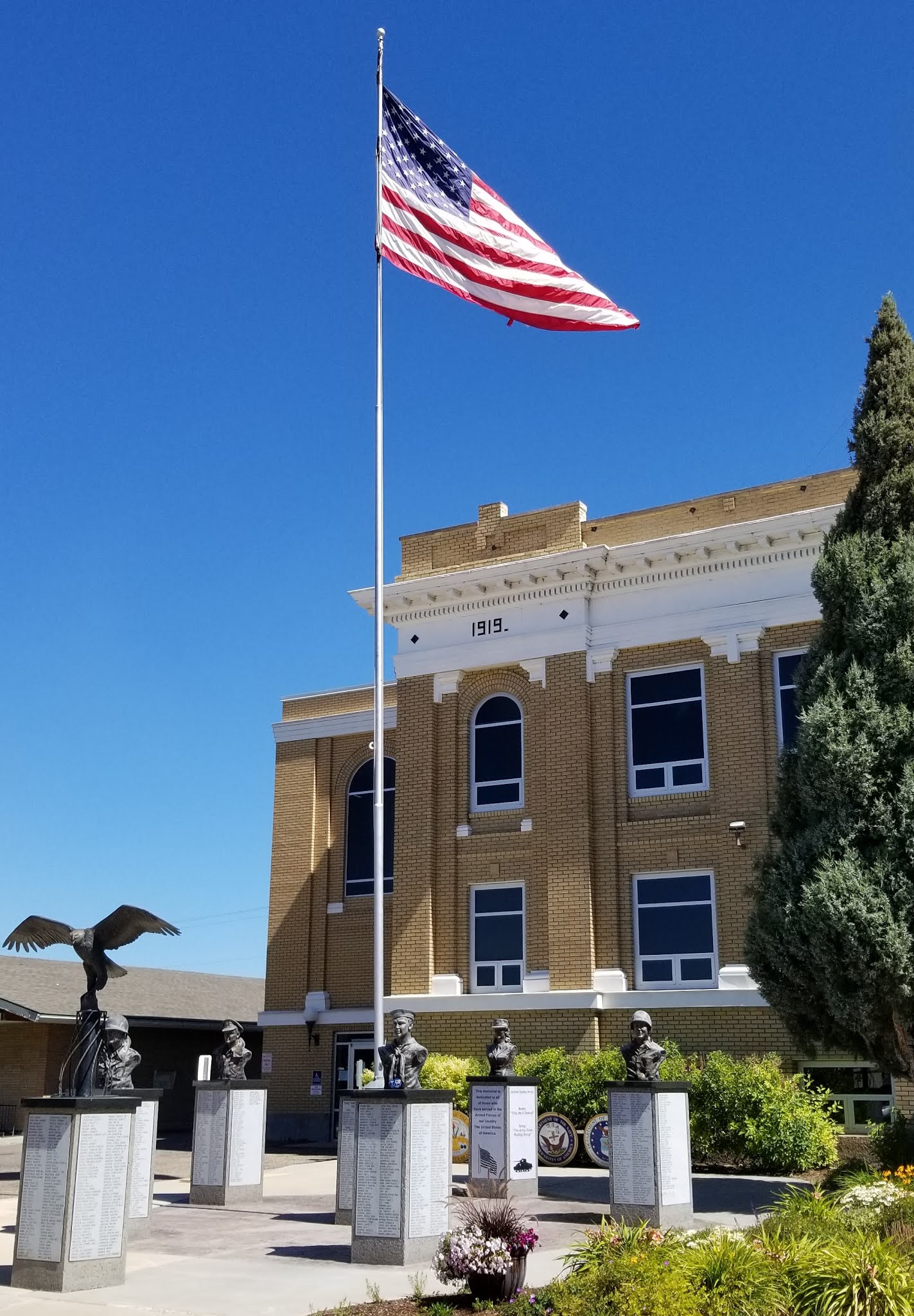 |
| Veteran's Memorial |
 |
| Trail from Soda Springs Geyser to Hooper Springs Park |
 |
| Hooper Springs Park |
 |
| Me taking a sip and a dip at the pool at Hooper Springs Park |
The Soda Geyser
Our time in resplendent, rugged, remote Idaho had come to an end. We had to migrate slowly to Indiana to have warranty work completed on our 1-year-old unit. But our touring along the way continued, so I’ll tell ya all about it in my next blog. Stay healthy and sane in these surreal times.
No comments:
Post a Comment