Friday, March 29, 2024

More Boondocking Fun, A Bucket List Item Done, and Enjoying New Mexico's Largest State Park

We departed Organ Pipe Cactus National Monument and headed to Sonoita, AZ.  I marveled at the colorful blooms that lined AZ-85:  blue desert lupine, orange globemallow, and the cheerful yellow brittlebush and desert marigolds.


We stopped in Gila Bend for fuel before getting on I-8.  Big mistake—we wasted 45 minutes dealing with long lines at the truck diesel lanes.  Fortunately, I-8 was a pleasant drive with little interaction with other vehicles.  Onto I-10, which proved to be a nightmare!  Traffic was horrific due to construction zones and overall poor road conditions.  It was like driving on a cheese grater! Consequently, a 4-hour trip to Bureau of Land Management’s (BLM) Las Cienegas National Conservation Area took us 6.5 hours!  And Mom’s allergies kicked in big time, causing her voice to get lower and raspy.  (Between you and me, this was a blessing in disguise.  We could barely hear her ranting and raving about the roads while she was at the wheel!)  Needless to say, we arrived later than anticipated at Sonoita, AZ on a Friday afternoon and were all tired from a stressful day of driving.


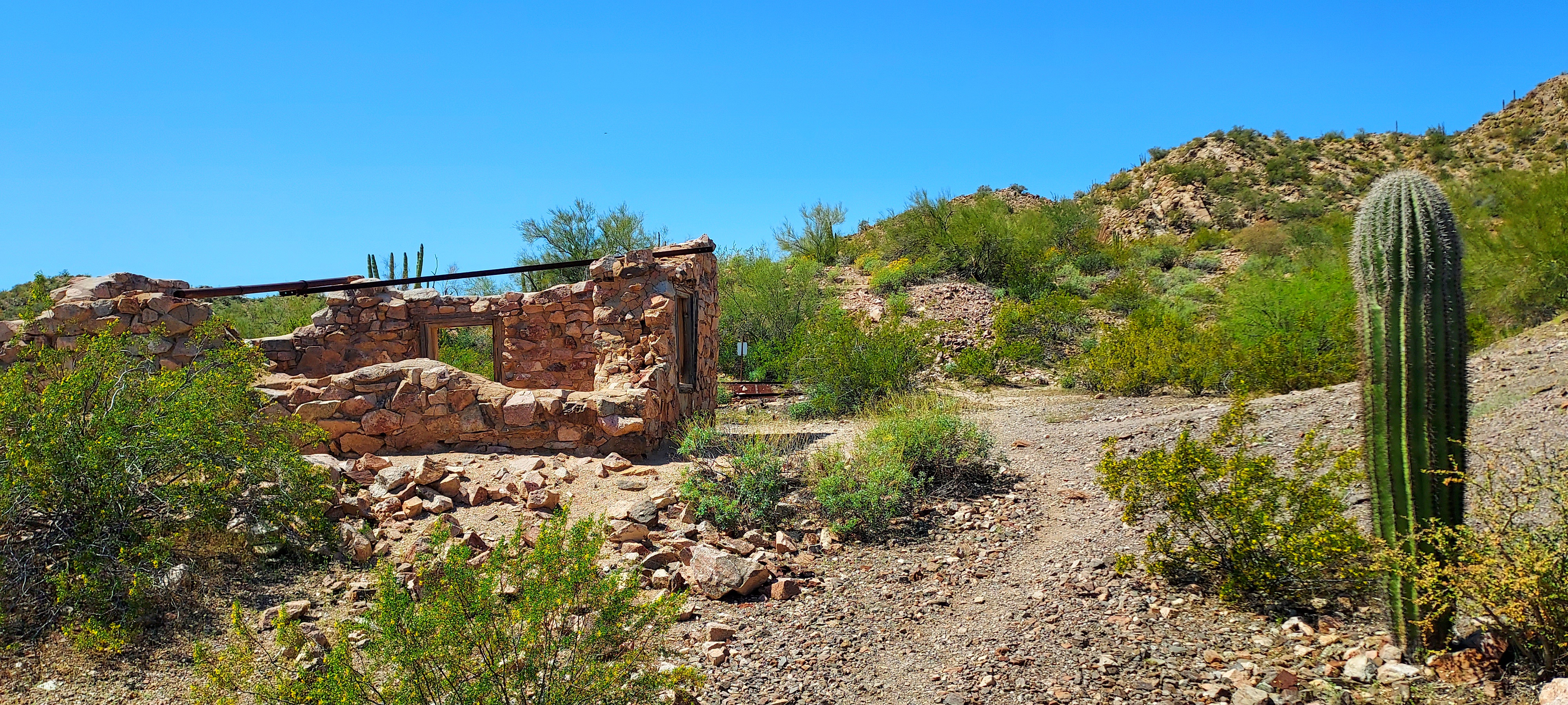
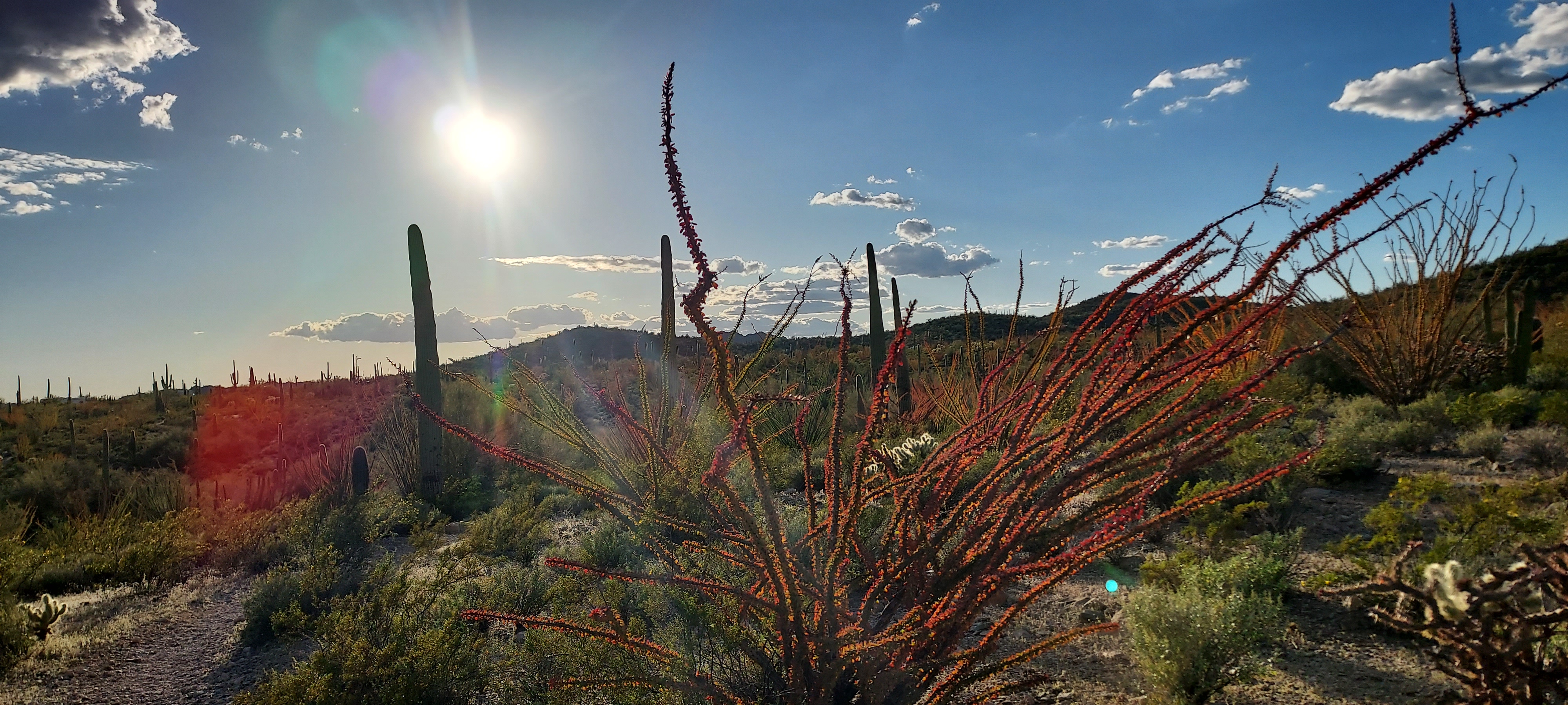
Some pretty scenery along our route.


Las Cienegas National Conservation Area is home to the historic Empire Ranch.  Established in the 1870s, it was once among the largest cattle ranches in all of AZ.   Today, cattle still graze on these lands.  Additionally, Las Cienegas includes a group camping area at the airstrip in Cottonwood Canyon, a non-reservable primitive camping area called Cieneguita, plus some dispersed camping sites.  Because we visited here previously we knew what roads on which our setup can maneuver, so we stuck to the 
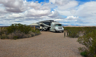
Cieneguita camping area, comprised of 6 huge horseshoe-shaped sites that, according to BLM, can accommodate 2 camping units (some actually had 3 big RVs parked on a site.)


Getting a fully unoccupied site did not look promising.  Rather than venture too far down the road (we  knew we would encounter a very tight turnaround), we went to the site we occupied on our last visit.  Unfortunately, that site had a 25-foot travel trailer on it already.  However, we reasoned that we would be parking about 100 feet away from the other unit and facing in the opposite direction.  And when we occupied the site on our last visit, we graciously shared the site with another camper who arrived later in the day.


Mom had barely exited the truck before she was approached by the site occupant.  Clearly, he wasn’t happy to “share” his site when Mom asked if it would be a problem.   He admitted, however, we would not find any sites unoccupied.  The man gave Mom the third degree:  how long are you staying; are you partiers; do you make a lot of noise; where are you from.    Now, with the mood Mom was in, I was worried she was going to unholster her NJ attitude (and with her laryngitis, she sounded like a full-fledged Jersey mob boss!)  After all, these are free, public campgrounds and lands.  There is no reservation system nor fee structure, and BLM states right on the campground info board that sites accommodate 2 rigs.  But I was so proud of Mom!  Though I saw her fingers twitch once or twice, Yosemite Sue transformed into Sweet Sue, and she diffused the situation with no backup from Dad.  She realized quickly if she asked, “may I”, her wish to share the site would be granted.   After providing acceptable answers to the occupant’s interrogation, permission to park was granted, and Mom thanked the site occupant profusely for his “generosity.”  We had no further problems or awkward encounters.  In fact, we only saw the occupant twice thereafter during our 3-night stay, and we were all cordial to one another.


We left plenty of room and privacy for the original site occupant--our rigs were facing in completely different directions.

We finished set up, took a walk, being sure to sidestep the cow patties, and sat outside to relax.  Nothing soothes the soul like an AZ sunset.


The moon rising...


and progression of the sunset...


The next 2 days were very windy, rainy, and downright cold.  So, Mom (our family’s Chief Financial Officer) focused on banking and taxes; I worked diligently on catching up on my blogs; and Dad kicked his feet up to watch some professional bull riding (PBR).  The sun finally peeked out about 4 p.m. on our final evening.  So, I joined Mom for a walk, feeling blessed to be surrounded by the natural beauty of the snow-covered Santa Rita Mountains and miles and miles of open range.  We moseyed over to Empire Ranch, which was hosting a private event, then continued to Cottonwood Canyon.  The Canyon’s emerald-colored canopy of cottonwoods contrasts sharply with the brown hues of the topography.   We spotted two antelope/pronghorn foraging for dinner and glimpsed 3 javelinas as they crested a hill.  Unfortunately, we captured no photos of the wildlife (what else is new).


Walking into Cottonwood Canyon


Some very cool clouds...

...that produced...

...a MAGNIFICENT sunset.


It was a chilly 40F degrees when we departed Cienegas National Conservation Area the next morning, and I noticed newly-fallen snow was covering the mountaintops.


As we reached Benson, AZ, my parents game me a wonderful surprise!  To celebrate my rescue from the toy store so many years ago, we were stopping at Bowlins “The Thing” Travel Center.  I was so excited!  I have wanted to visit since our first trip to AZ in 2015!  “The Thing, Mystery of the Desert” exhibit has been a roadside attraction for decades.  But in more recent times, Bowlins Travel Center has dedicated an entire Museum to “The Thing.”  I don’t want to spoil the experience for any future visitors.  However, the Museum sets forth a cleverly-crafted tale connecting aliens, dinosaurs, humans, and the oddity known as “The Thing”, compelling us all to ask,  “What if…?”


Here's another "What if" scenario:  What if I am related to "The Thing"?


"Mystery of the Desert" - AKA "The Thing"


It is all a bit cheesy, but we all know how much I love cheese!  Interesting, suspenseful, and well worth the $4/adult ticket. And even if you don’t want to partake of “The Thing” exhibit, the Travel Center is worth a stop.  Bowlins is like a mini version of Wall Drug in SD.  It has merchandise like clothing, jewelry (Dad saw a very cool snake head bolo), toys, blankets, Kachinas, etc., a real haven for collectors of knickknacks and tchotchkes.


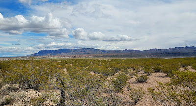
We returned to the road for our destination of Elephant Butte Lake State Park, located in Truth or Consequences, NM.  It is New Mexico’s largest State Park, stretching 40 miles and creating 200+miles of shoreline. This was an easy drive—until we hit some nasty rain, sleet, and chilly temps and an I-25 North ramp closure outside of Hatch, NM that detoured us about 16 miles.


There are various campgrounds within Elephant Butte Lake State Park, but we reserved a site in South Monticello Campground.  The Campground is a mere 8 miles off I-25 via Rock Canyon Road, but it is hidden so stealthily in the valley that that you would never know it was there.  Though Rock Canyon Road is built to accommodate two-way traffic, Mom sure was glad we didn’t encounter any other vehicles on the tight curves. 


South Monticello Campground is a gem with huge sites, including many pull-throughs.  There are back-in sites with waterfront views of the reservoir, which was created by the damming of the Rio Grande River.  And what a bargain at $18/day with water and electric hook-ups and an easily-accessible dump station right as you enter the campground.  Even though the campground is all one-way traffic, the roads are double-wide, making it a piece of cake for big rigs to maneuver.


It was extremely windy, cloudy, and downright chilly during most of our 3-day visit.  So, it was nice to have the electric hookup so we could enjoy the warmth and ambiance of our fireplace (something we could not enjoy during our 3 prior months of boondocking since the fireplace is a major energy hog).


Weather be damned, we hiked 5-6 miles each day along West Lake Shore Trail.  This is an 11+ mile, well-maintained, well-marked out-and-back trail that runs from one end of Elephant Butte Lake State Park to another.  We enjoyed serenity and solitude, encountering only 3 other people during all of our hikes.   I was happy that we logged several geocaches along the trail, too, including one at 3 Sisters Point.


We also hiked down to what was once a dock, but dramatically-diminished water levels preclude its use now.  Eureka!  I found yet another geocache!


We departed Elephant Butte State Park for a 1-night stay at Escapees Dreamcatcher RV Park in Deming, NM.  We utilized the last of our complimentary stay certificates that we earned in 2018 while volunteering/workcamping for 3 months at Escapees Rainbow’s End RV Park in Livingston, TX.  (Work-camping opportunities are available for Escapees singles and couples.  20 hour total commitment in exchange for complimentary RV site, electric reimbursement, and complimentary stay certificates.  For specific info, contact Cindy Neilsen at parks@escapees.com).  


After set-up and lunch, Mom prepared the table for me and my rat pack to do Easter egg coloring.  All was going well.  We pulled the first 6 eggs out of the dye, and placed the next 6 in.  Then Mom made a fatal error—she left me under Dad’s “supervision" for 5 minutes when she ran to the RV Park office to get quarters for laundry.  When she returned, she found me stripped down to my birthday suit, my shorts converted in color from white to pink, and Dad trying to clean up the spill evidence.  At least my parents were able to get the stains off of me.  I wouldn’t want my adorableness ruined by having multi-colored fur!

All was going well--before the spill.


Well, time for me to sign off.  I've got to get my clothes back on!  I’ll talk to you again soon!

Saturday, March 23, 2024

Visiting Organ Pipe Cactus National Monument – Why, AZ

We left Quartzsite on a gorgeous Spring day, dumped our waste tanks, put in fresh water, and headed onto I-10.  I marveled at the wildflower blooms that adorned both sides of the highway lanes.  Traffic was heavy, but thankfully, we didn’t need to take I-10 through Phoenix.  Outside of Buckeye, we turned on to AZ-85, passing through Gila Bend.  Once a stop on the Butterfield Stagecoach route, Gila Bend is home to the Space Age Lodge and Restaurant, a Roadside America attraction.  We continued through Ajo, an old copper mining town.  The now defunct New Cornelia Open Pit Copper Mine can be seen from the highway, and boy it is HUGE!


A Spanish-styled church in Ajo

The open pit mine from afar...

...and a close-up.  A wide array of colors in that earth!


As we approached the entrance to Organ Pipe Cactus National Monument, I spotted the crested saguaro that friend Ruth told us about.  Some pretty scenery around here.


A birdie sits on the top of the saguaro in background.

The crested saguaro friend Ruth told us about.

Some funny-shaped saguaro--they've got lots of arms.


We proceeded to Twin Peaks Campground, which has no hookups.  There is, however, a dump station, and water spickets are located throughout the campground.  Though fairly large (200+ sites), it is well designed.  Sites are designated for specifically-sized rigs, tents, and even generator usage.   They are all beautifully and naturally landscaped, providing privacy and desert ambiance.  We were fortunate to land 1 of only 4 sites to fit extra big set-ups (45+ feet).   All campground roads are one-way, making entry and exit into the sites a piece of cake.


After setting up and partaking of lunch, we hiked the Palo Verde Trail over to the Visitor Center.  Much to Mom’s dismay, the Park offers no film, but they do have a Junior Ranger Program for me!  We perused the Center and walked along the nature trail.


One of the hundreds of Organ Pipe Cacti for which the Monument is named. 


You're looking at a newly-deputized Jr. Ranger of Organ Pipe Cactus National Monument.

Returning home to the campground just as sun was setting.


We attended 2 interesting interpretive programs presented by park volunteers.


The first program was about the restoration of Quitobaquito Springs.  Used as a water source along a prehistoric trade route, it represents the second largest year-round oasis in the Sonoran Desert.  During its first 10,000+ years, it was all marshland, used by many indigenous tribes.  In the 1860s, local merchant Andrew Dorsey created a clay-based pond and dam for watering the fig and pomegranate trees he planted.  Since then, there were further changes and much degradation, threatening the lives of 3 endangered species who call the Springs home.  Therefore, a coalition of stakeholders—land managers, policy makers, scientists, and representatives from the Tohono O’odham Nationcame up with a plan.  To benefit the endangered species, they decided to bring the Springs back to the 1860s pond.  They were successful in their endeavor and completed the project in 2022,  though for the life of me, I can’t believe they used a giant PLASTIC LINER to replace the pond’s clay base!  It’s now like a freaking swimming pool!  But, alas, what do I know—I am just a cotton-brained stuffed rat.


Now, the second interpretive program was of major interest to me.  You see, it was dedicated to my distant cousins:  pack rats!


I learned that they live in middens, chambered fortresses built in cacti, under rocks, etc.  They reside under cover because they are terrified of the open sky and what predator may be lurking! (This fear is why you should always leave the hood of your vehicles open overnight in areas where pack rats are prevalent.  Failure to do so may result in these rodentia feeling safe enough under the darkness of your hood to enjoy a smorgasbord on your vehicle wires!).


Replica of a pack rat's midden.


The female pack rat is the midden Matriarch.  She lives alone, passing her “real estate” down to her daughter.  The Matriarch is an avid collector.  She builds and decorates her digs with things found in her travels (twigs, shells, feathers, rocks, garbage, leaves, scraps of cloth, etc.  She has rather eclectic taste in decor).  She adheres her treasures to her walls with her unique version of 3M Command Strips:  her urine! Scorpions and brown recluse spiders will often “rent” space in the pack rat midden.   Pack rats do not drink water, but rather hydrate through eating succulents.  What a fascinating program!  And I realize more each day how this world is entwined and woven together so intricately.  It is easy to understand why Organ Pipe Cactus National Monument is names by the United Nationals Educational, Scientific, and Cultural Organization (UNESCO) as a biosphere reserve.     


During our visit to the Monument, we also hiked the Victoria Mine Trail, from which you can view the border wall between the U.S.A. and Mexico.


Sign along the Victoria Mine Trail since we were within 5 miles of the international border.


Can you see the U.S.A./Mexico Border Wall in the background?

I wonder if this lizard is an illegal border crosser?

Sadly, if the border wall existed in 2002, perhaps Ranger Kris Eggle would still be alive.  Instead, Ranger Eggle was slain in the line of duty by illegal border crossers smuggling drugs into the U.S.A.  The National Park Service erected this monument at the Visitor Center in memory of Ranger Eggle.


This stone cabin and a few sealed mineshafts are all that remains of the Victoria Mine, where gold and silver were mined commencing in the 1890s.


The ocotillo are starting to bloom.


We also did several laps around the Campground Perimeter Trail.   

I spotted a pack rat midden hidden in the center of this cacti!


Such beauty, tranquility, and biodiversity we have enjoyed!  So glad we were able to visit this National treasure!