Oh, The Places We Go - Touring North Central Idaho, Part I
North Central Idaho is a resplendent area, mostly wild,
rugged, and remote.With the majority of
its mass comprised of public lands protected by government regulations, it is a
paradise for boaters, fishermen/women, paddlers, ATVers, and hikers (we fit into these latter three categories). Several towns
have Rails-to-Trails paths for bicycle enthusiasts to enjoy.North Central Idaho’s forests of ponderosa
pines dotting the hillsides are reminiscent of the Black Hills of South
Dakota—as are the winding, curvy roads that we motorcyclists love to ride.And, with its many scenic, secluded, and free boondocking pullouts,
free freshwater spigots and free dump stations located at various small
locales, the area is very amicable to RVers and tent campers alike.
We had more precipitation (including snow!) and cooler
temperatures than we expected during May and June, but that didn’t stop us from
having a blast.And once July arrived,
we enjoyed clear skies and hazy, hot, and humid days.Dad purchased turn signals, horn, solid side
doors and an Idaho OHV sticker, so we got tremendous use out of Rat Patrol II,
our Polaris RZR side-by-side, logging over 1,000 miles!So here is Part I of our sightseeing adventures
during our volunteer commitment at Dworshak Dam.
Ahsahka.This
town was our “backyard”, where Dworshak Dam, Volunteer Village, Big Eddy and
Bruce Eddy Day-Use Areas, and the Visitor Center are located.We took advantage of 4 of the 5 hiking trails
within the Ahsahka Ridge Trail System, granting us great views of the Reservoir, the Clearwater River, and its valley.The Corps of
Engineers brochure stated that the East Ridge and West Ridge trails were easy
“without much elevation change”.I don’t
know what they were smoking when they made that determination.The All Trails app that Dad consulted (gee,
thanks for checking that after the fact, Dad) described them more accurately as
moderate.We didn’t do the Pilot Pole
Trail since the Corps’ brochure classified it as “a workout in both
directions”.Based upon our experience with the other
trails, we figured that would equate to climbing the Swiss Alps for us!The sweet scent of honeysuckle and lilacs
tickled my nose as we hiked.Later in
the season, we enjoyed picking wild berries, cherries, and plums at various
spots in the area.
Me with Ranger Michelle accessing some of the more remote camping areas on the reservoir!
Wildlife was abundant here, with wild turkeys, multi-generational quail families, and a variety of birds clearly enjoying the seed we provided.Our feeder became Hummingbird Central, with 3 hummingbirds fighting for a seat!The deer loved our lettuce and tomato plants, clearly thinking we set out a vegetable buffet just for them.We encountered skunks, squirrels, some "open range" goats, and even a bat who was hanging out in the Bruce Eddy Bathroom, not to mention a variety of insects, amphibians, and reptiles.
This lass was a bit perturbed that we moved the lettuce plants off the "buffet". She was finding them quite tasty. She opted reluctantly for the tomato plant.
California Root Borer Beetle
This mantis is praying to find a mate--which will then become her dinner.
This fellow was driving me batty in the Bruce Eddy Bathroom!
Lorquin's Admiral Butterfly
A Western Tanager visited us
Wild turkeys
Some goats decided to become "free range".
With the arrival of a volunteer in mid-June, the Dworshak Dam Visitor Center opened to the public. So, we had our first opportunity to peruse area information.We viewed films depicting how integral the Clearwater River was to the logging industry.For 40 years prior to the damming of the North Fork of the Clearwater River, Potlatch Forest Inc. (formerly Clearwater Timber Company) would perform log drives, floating logs down the River to the lumber mills located in Lewiston.Workers ate and slept on a floating “mini city” that would precede the logs downriver.The whole operation looked super cool.However, the Clearwater River’s continual flooding of Orofino and surrounding areas (36 out of 50 years) resulted in the completion of the Dworshak Dam flood mitigation project in 1971.Our behind-the-scenes tour of the Dam was fascinating.As the third tallest dam in the US, the tallest straight axis concrete dam in the Western Hemisphere, and at a cost of $327M with only 4 deaths, it is quite a modern marvel!While on the tour, we saw a beaver!Apparently, he got stuck in one of the drainage troughs.Rangers rescued him, but they put him to work eating/removing vegetation.He has done a pretty good job since last fall, but me thinks he is a bit lonely.Maybe they can drop a female beaver in there with him! With all the knowledge I attained, I was well equipped to earn a Dworshak Dam Junior Ranger Badge to add to my collection.
The belly of the beast
A lonely, but very hardworking beaver, eating vegetation near the dam.
It was
quite a thrill to watch current logging operations go on at Big Eddy late in
the season.These lumberjacks are in
phenomenal shape, hiking up the mountain while carrying a chainsaw and
gear. Afterwards, helicopters would remove the downed trees.
We were disappointed we couldn’t
visit the Dworshak National Fish Hatchery, but it prohibited anyone from taking
the self-guided OUTDOOR tour throughout the summer.Sounds like an “over abundance of COVID
caution” to this stuffed rat.
Lewiston.Home
to Hell’s Gate State Park, which has a nice campground, beach area along the
Snake River, hiking and biking trails, and the Lewis and Clark Education Center
(though the Education Center was open only for campground registration purposes
because of the ‘rona virus).We had the
good fortune to catch up there with our RVing friends Ruth/Dale and my fav feline,
Tazzy.We returned later
in the summer several times to do more extensive hiking and peruse the outside
exhibits regarding the Lewis and Clark Expedition, which took place from
1803-1806. Tasked with finding passage west to the Pacific Ocean while
establishing diplomatic relations with American Indians and documenting flora
and fauna, they had a rather tall order to fill.But they persevered and were successful in
their mission.Sadly, 3 years later
Lewis reportedly committed suicide.Perhaps nothing in life thereafter could give him the same thrill or
sense of achievement as the Corps of Discovery Mission.A scenic overlook of the confluence of the
Clearwater and Snake Rivers is also found in Lewiston.We took Big Boomer down The Old Spiral
Highway, the precursor to US-95 here.Constructed in 1917, the roadway contains more than 60 turns within 7
miles, and it descents approximately 2,000 feet.It was so very cool that we did it again with
our motorcycles on a subsequent trip!The
City’s historic district contains its oldest home and Idaho Territory’s first
Capital building.Lewiston has a
terrific store called North 40, a combination of Tractor Supply and Cabella’s
all under one roof.Within a short 45
minute shopping spree, my parents purchased $600+ of cat food, fishing equipment,
electric connectors, a steel box for our buggy, and their Corps-required
steel-toed work boots (a major feat for Mom, whose short and fat “Fred
Flintstone” feet make it difficult to get any type of footwear, let alone
steel-toed shoes).It has a great
selection of merchandise and helpful, courteous sales associates.Nearby is Ernie’s Steakhouse, which provides
ambience, nice portions, and good food.Mom and I, forever carnivores, shared a French Dip made from fresh,
local Idaho beef. We were impressed that a steakhouse had options (other than a
bowl of rabbit food) for Dad, who enjoyed a tasty beanburger/portabello
mushroom combo.
Ruth/Dale and my fav feline, Tazzy!
Old Spiral Highway in foreground
Confluence of Clearwater and Snake Rivers
Idaho Territory's First Capital Building
Oldest House in Lewiston, circa late 1860s
Lewiston Rose Garden
Orofino.As the
seat of Clearwater County, Orafino has a rather large population by North
Central Idaho standards (approx. 3,200 people), and it services its residents
with three small food stores:Hometown
Market, Harvest Foods, and Hayes Ace Hardware.Yes, you can buy produce, meat, booze, paint, and a nail gun all at Ace!Since
only 7 miles away from the Dam, we spent many hours at the County Park in
Orofino to get internet access.It is a
simpler life here, reminiscent of the times during which my parents grew up.It warmed our hearts to see that children
here were playing Little League, hanging on swings and slides, building castles
in sandboxes, riding their bicycles through mud puddles, and entertaining
themselves WITHOUT any electronic devices.Adults would also enjoy the park for picnics and barbeques, exhibiting
the lost art of verbal conversation.Each
year, Orofino hosts a Car Show to raise money for scholarships for local
students.We saw some oldies but
goodies, including some classic campers!Trying to help the small, local businesses post-COVID shutdown, we ate
out more during this summer than in the last 3 years!We were patrons multiple times at nearly
every restaurant
in Orofino (though our favorite was The Edge, waterfront dining
along the Clearwater River at the Best Western Hotel), enjoying the company of
some of our fellow workcampers on occasion.Nearly every week we would patronize Orofino's small movie theater to view 1980s
films like ET, Goonies, and Ghost Busters, to name just a few.We so appreciated the efforts of the local
townspeople who personally funded and produced Orofino’s Independence Day fireworks.There is such a sense of community here.
The Rex Theater was a treat since we had no television and limited cell service.
Independence Day Celebration, funded AND produced by local residents--no tax dollars spent here!
Orofino's Annual Car Show
My favorite car show entry
Blanchard.We
spent a wonderful weekend here at Stonebridge Resort, about ½ hour north of
Coeur d’Alene.The Resort is gorgeous
and offers a multitude of amenities like pool, jacuzzi, theater room, and
exercise room in its Recreation Center.In addition to an 18-hole PGA-rated
golf course, it provides mini golf, walking trails, tennis courts, and pub—you
name it, Stonebridge has got it.We were
pleasantly surprised to find that our room had a king size bed, a large sitting
area, a full kitchen with dinette, and a balcony overlooking the 13th
hole.And me thinks they installed Cosmo Kramer’s
(from Seinfeld) Commando 450 showerheads based on the powerful flow of water
coming out of them!We booked at an
unbelievably low price of $125/night (thank you COVID)! Since it is a time share resort (of which we were not aware at time of booking), there is no
maid service. Therefore, Mom was responsible for making our bed each day and doing turn down each evening (but
she neglected to leave a Babybel cheese on my pillow).Stonebridge
is top notch and earns one of my coveted 5-cheese awards.And it provided us an opportunity to get
together with wonderful friends Curtis/Stephanie who live nearby.I joined the guys on the golf course, acting
as Dad’s caddy (though I think Dad should invest in a remote-controlled
motorized golf bag instead of relying on me) and stroking his wounded ego when he
blew a shot.Mom and Stephanie traversed
the walking trails, visited the nearby housing development, and checked out the
RV lots that could be purchased for a mere $165,000, on average. We enjoyed breakfast each morning at Annie’s
Kitchen, a quaint, homey café with freshly prepared food and friendly,
efficient service.And we spent our
evenings visiting Curtis and Stephanie’s 20-acre farmette.Their lovingly-tended fruit trees, vegetable
gardens and flower beds are an avian paradise!
Eclectic decor at Annie's Kitchen.
Great folks, Stephanie and Curtis
Moscow. A fun,
college town, Moscow is home to the University of Idaho.We visited the school’s Arboretum in late May, a haven of peace and
tranquility in an unsettling, surreal world.We returned in late July for another congenial visit with Ruth/Dale and
the chance to witness the seasonal changes in flora and arbor foliage.We visited the town’s Farmer’s Market and
were pleasantly surprised to find the HUGE assortment of fresh produce
available.It is, by far, the finest
Farmer’s Market we have attended in about 20 years.Therefore, it receives a coveted Rambling RV
Rat 5-cheese award. On another occasion,
we visited the Appaloosa Horse Club and Museum.Originally bred by the Nez Perce American Indians who inhabited the
Palouse River region (hence the evolution of the name Appaloosa), these horses
have distinctive spotted coats and striped hooves. The resident Appaloosa,
Dusty, was quite a striking specimen.For
more than 50 years (except in 2020, when COVID caused cancellation), the
Appaloosa Horse Club hosts the annual Chief Joseph Trail Ride.The ride retraces the 1,172 mile trek that
the Nez Perce tribe took in 1877 to escape capture by the US Calvary, another
heart-wrenching tale of a peaceful tribal nation forced to leave their
homelands.
My parents with Ruth/Dale
Beautiful painting at Appaloosa Museum
Dusty, the Appaloosa Horse Club's resident
Nez Perce National Historical Park, Museum, Visitor
Center.While out riding our motorcycles through
Spalding, Idaho, we were fortunate to catch the Museum and Visitor Center open
(they were closed for the majority of the summer season).The homeland of the Nez Perce, whose name in
their traditional language means “we the people”, consisted of most of North
Central Idaho, Northeastern Oregon, and Southwestern Washington.Prior to 1855, they were peaceful and
welcoming, even assisting Lewis and Clark.Later, when westward bound pioneers began settling in Nez Perce
homelands, the U.S. government established a treaty with the Nez Perce, awarding
7.5 million acres, less than half of their ancestral homelands.But, once gold was discovered, the
Government, true to form, reneged on its agreement, taking back 90% of the Nez
Perce lands.While some Nez Perce signed
the new treaty, other bands refused to do so.Instead, they began a long, difficult journey through mountainous
regions to avoid capture by the U.S. Calvalry and to reach Canada where they
could continue their traditional lifestyle.For the Nez Perce, it is a story of fortitude, bravery, cultural
misunderstanding, sadness, and great loss. What I most admire about the Nez Perce is
their spiritual belief of One Creator.They tell the tale of a single rope coming down from the heavens,
breaking into many strands.Each strand
represents a different religion.But ALL
the strands lead back to the single rope.Nez Perce mythology often centers on Coyote, representative of
Earth.One of their tales describes an
arched rock formation we visited.In
this legend, Coyote tries to intervene in an argument between Ant and
Yellowjacket, but they both ignore Coyote.Angered by their inattentiveness, Coyote turns Ant and Yellowjacket to
stone just as their backs were arched with their jaws locked in combat.What a spiritual moment we experienced to see
THREE hawks sitting on that very rock formation as we finished reading this
tale!Ant and Yellowjacket is just one
of the 38 sites collectively known as the Nez Perce Historical Park located
throughout Idaho, Washington, Oregon, and Montana.During our stay at Dworshak Dam, we visited
half of these sites, including, but not limited to, White Bird Battlefield, Canoe Camp, and Heart of the Monster, their traditional creation site.
Once the homeland of Nez Perce, this became the homesite of the first permanent white settler in Idaho.
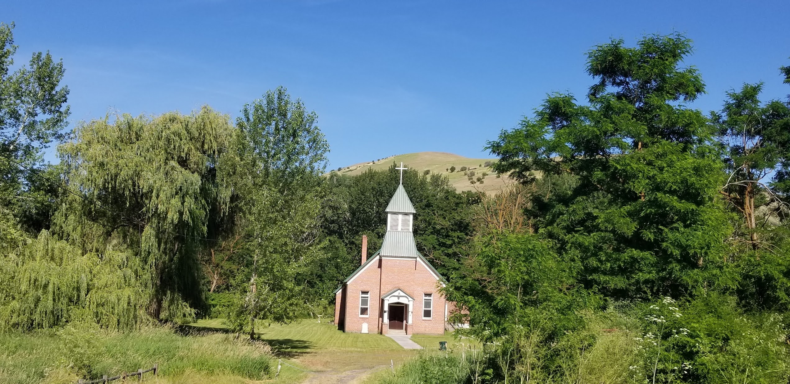
Spalding Presbyterian Church, part of the missionary grounds. Many Nez Perce converted, with some becoming ministers themselves.
Site of Nez Perce Village, circa 1905...
...and now.
Heart of the Monster
Pullman, Washington/Palouse Scenic Byway.Known as The Lentil Capital, Pullman is the largest city in Whitman
County.More lentils, barley, and wheat
are produced in Whitman County than any other county in the entire U.S.A.,
which was quite evident as we traversed the Palouse Scenic Byway and witnessed
a vast expanse of green fields dotting the rolling hills.Later in the season, we viewed the
transition from green fields to barren, earthen lands, as farmers readied their
plots for their winter crops.Sadly, our
plans to attend Pullman’s Lentil Festival were foiled by COVID.Since we arrived in Idaho, we have attempted
to purchase e-bikes in Moscow and Lewiston, but to no avail.We had high hopes for success in Pullman,
since it is a college town (Washington State University).But alas, Strike 3.Every shop in every city imparted a dismal
outlook:out of stock, waiting for new
shipments, don’t expect anything before September/October.I guess it is one positive outcome of
COVID:in an attempt to escape lockdown,
people took to the outdoors and bicycles have been in high demand.
Northwest Passage Byway/Route 12.Interestingly, Idaho has loads of
Byways.But the Northwest Passage Byway
is, at 202 miles, its longest.It
follows the route Lewis and Clark took on their expedition through Idaho,
leading you to Lewiston from towns like Kamiah and Kooskia, located within the
Nez Perce Indian Reservation. While
riding motorcycles along this passageway, we saw the First and Second Indian
Presbyterian Churches and watched folks float down the Clearwater River.We were going to stop for some refreshments
at the Nez Perce It’se Ye-Ye Casino (which translates to “coyote”) until we saw
it is about the size of a gas station convenience store. On one occasion we caught up with new friends
Sherry/Steve, fellow DRV owners, who were staying at an RV park in Kamiah.They introduced themselves to us a few weeks
earlier when they came to Dworshak Dam Visitor Center.One of the wonderful attributes of RVing is
always meeting new people and creating new friendships!
Later in the season, we watched people tube down the Clearwater River from here.
First Presbyterian Indian Church
Second Presbyterian Indian Church
New friends Steve/Sherry
Julietta/Kendrick.These were once bustling towns serviced by the Northern Pacific
Railroad.It is sad to learn of the rise
and demise of small towns in conjunction with the railroad (A saw mill and
grain elevator are still in operation today, though they are filling trucks
rather than rail cars.)Today these
communities have a combined population of only 900 residents, and their rail
lines have been converted to hiking/biking trails, which we traversed on an
occasion or two.Kendrick’s entire main
street is on the National Register of Historic Places, with most of its
buildings erected in 1905.We ate
several times at Archie’s Café, a quant luncheonette style eatery that we
stumbled upon while out riding motorcycles one day.Archie’s serves down home simple cooking, but
they also have a couple of options for Dad on their menu.It was a pleasure meeting and chatting with
owners Archie and her brother, Jughead.These folks have worked their tails off 6 days a week, 12+ hours a day,
for the last 8 years.They represent
Main Street America, the small business owners whose livelihoods have been
devastated by the COVID restrictions implemented earlier in the year by the
Governor.
Wall mural and flower garden in Kendrick
Dent.We took
a scenic 25-mile buggy ride to visit Dent Acres, the full-service campground
operated by the Corps of Engineers on the other side of the Reservoir from
where we were stationed.We met the
campground hosts and chatted a bit.No
way could we fit in this campground!We
hiked Trail 440, which looked like it hadn’t been traversed in quite some
time.Running along the cliff wall, it
was one of those trails that if you make one wrong move, you are in the
water.
Dent Bridge
Hawk nests on the bridge towers
Dworshak State Park/Communities Along Cavendish Highway. We loaded into Rat Patrol II to visit Dworshak
State Park.We checked out the
campground, marina, and day-use area, then traversed all the hiking trails
there, including a portion of Big Eddy.We had a great chat with volunteer “Cowboy”, a fellow Texan, ATVer, and
Hook ‘Em Horns fan.Afterwards, we
buggied through the unincorporated farming communities along Cavendish Highway
like Cameron, population 29, home to the “Bumper Crop”.It was on Cavendish Highway that my family
spent an evening under the stars in July.We watched the International Space Station (ISS) go by, marveled at the clear
and crisp Milky Way, and viewed the once-in-a-lifetime comet Neowise (though I
am well preserved, not even this stuffed rat will be around 6,500+ years from
now to see it reappear).
Bumper Crop
Well, my virtual mouth has been motoring for way too
long!But I’ve so much more to tell you
about the places we visited!So, I will
talk to you again soon!


No comments:
Post a Comment