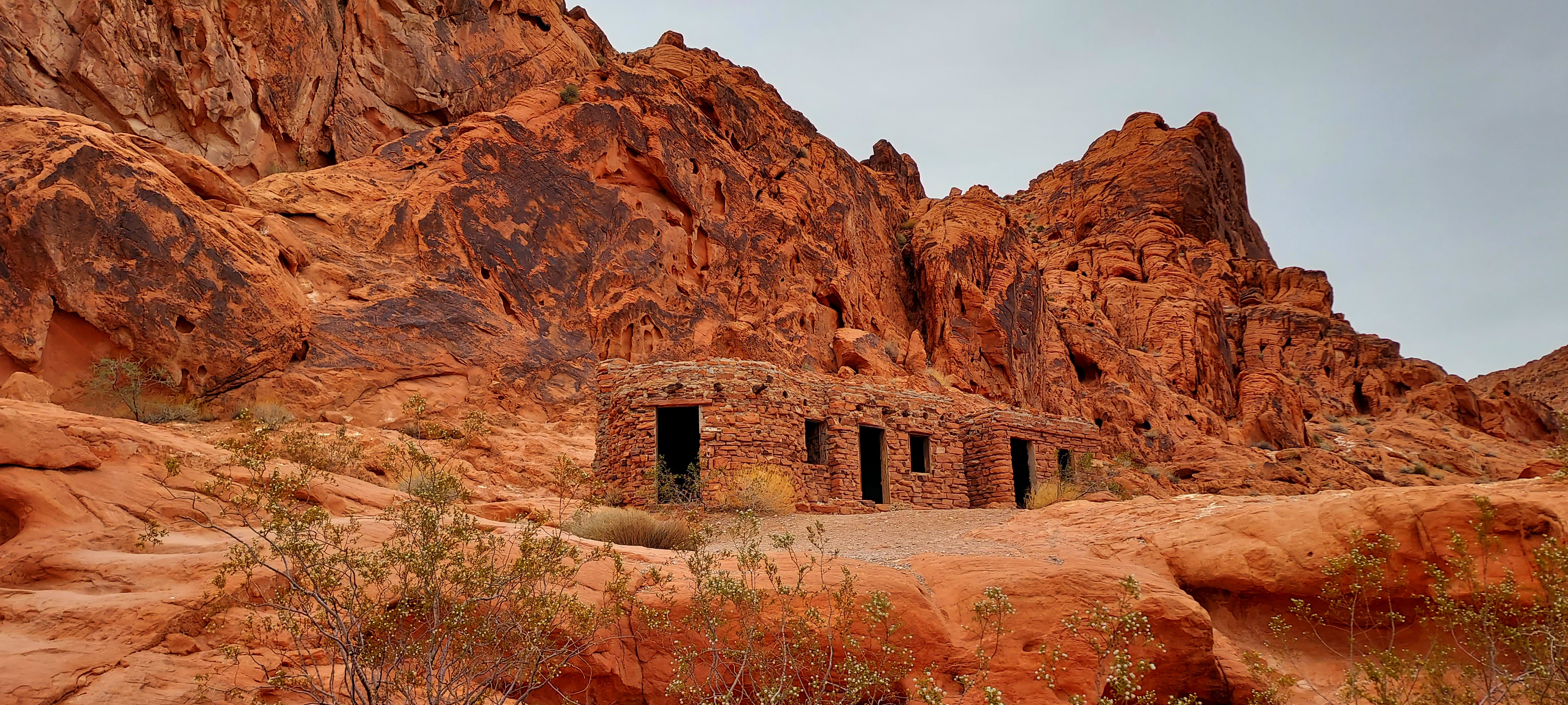
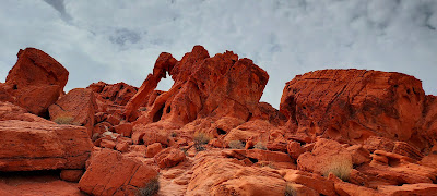
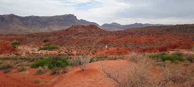
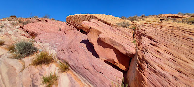
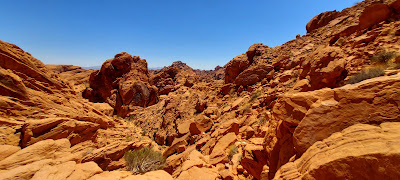
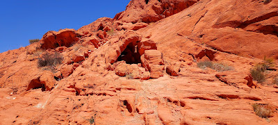
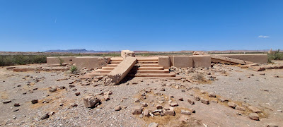
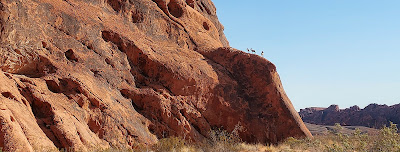
We left Valley of Fire State Park in Overton, NV and arrived at Parowan Petroglyphs in Parowan, UT for boondocking overnight. This is the second time we stayed at this dispersed camping site operated by the Bureau of Land Management (BLM), and it is a gem. It is an easy on/off of I-15, is sparsely populated, has lots of hiking and off-roading trails, and contains tons of interesting petroglyphs believed to date back 12,000 years. We had decent Verizon cell service where we parked, too. This site also has an area that showcases dinosaur tracks, though many of the tracks are now unrecognizable due to vandalism and/or erosion. We hiked 6 miles, took in all the sights, enjoyed the Spring blooms, watched a sunset, and even logged a geocache. These are the simple pleasures of life for which I am so grateful to our Creator.


 |
| Sunset as you look through the "gap" |

What a difference a day makes! When we left Valley of Fire at 8 a.m. to go to Parowan Petroglyphs, it was 80F degrees. Leaving Parowan Petroglyphs exactly 24 hours later, it registered 41F degrees! As we traversed UT-20, I noted all the gorgeous scenery, so lush from the Spring snow melt. As we were approaching Bear Valley, we passed a section of the Old Spanish Trail. I would have enjoyed traversing a bit of this historic path, but Dad had nowhere to park Big Boomer and Suite Retreat. We traveled along US-89 and entered Dixie National Forest, where we saw a sprinkling of hoodoos. We visited Bryce Canyon National Park in the Spring of 2016 enroute to Alaska, so we just continued onto UT-12 to the town of Escalante, where we entered Grand Staircase-Escalante National Monument. We opted to boondock for the week at the BLM’s Hole in the Rock dispersed camping area. This is a HUGE area with nice views, fairly flat/level sites, and scattered juniper and pinion pine trees to provide shade/privacy. They have no water source nor dump station, but they do provide trash dumpsters. Our Verizon cell signal was pretty good within the boondocking area, but more sporadic when we traversed further down Hole in the Rock Road. One thing we noticed is that many off-roaders, back-country hikers, and groups park in the large area on the left side of the road as you come through the entrance of the dispersed camping area. We were glad we didn’t park there as we initially intended, ‘cause we would have been surrounded by cars, hindering our ability to even move to another area.


After we unhooked Big Boomer and set-up of Suite Retreat was completed, Dad unloaded Maximus the trike and Rat Patrol II, our Polaris RZR side X side. In anticipation of doing extensive off-roading, we purchased our UT non-resident off-road permit for $30 plus a $5 on-line surcharge.
Our first stop via Maximus was at the Interagency
Office. Though there are no fees to
boondock at Hole in the Rock, BLM requests that folks register with them, so we
happily obliged. Then we picked up my
Junior Ranger booklet, watched the film, and perused the Visitor Center as I
diligently worked on earning my badge, which I was awarded later in the week.
Up next was a visit to the Hole in the Rock Heritage Center. We watched a riveting film depicting the
ordeals the Mormons faced as they traveled from Escalante to Bluff, UT to
establish a settlement there. To see
what these folks accomplished, their dedication to their mission, their
perseverance in the face of adversity—what an inspiration to us all! But I know they had some help. Divine Intervention can never be denied. You see, the gap within the rock towering
above the Colorado River was just wide enough to fit their wagons, no one died, and no one was seriously injured during their challenging trek. The Center’s docent provided us insights as
to how the Mormons specifically accomplished the task of getting down to the
River through the rock. As a descendent
of one of the original families to settle in Escalante, she was quite
knowledgeable on the subject.


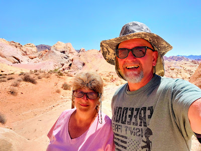
We were all excited the next morning to take Rat Patrol II to the various points of interest along Hole in the Rock Road. Our first stop was Devil’s Garden. We meandered through some varied topography, enjoying the unusual rock formations and hoodoos. The site has a picnic area where you can rest and contemplate, though you may be sharing it with a local lizard doing his exercise routine.


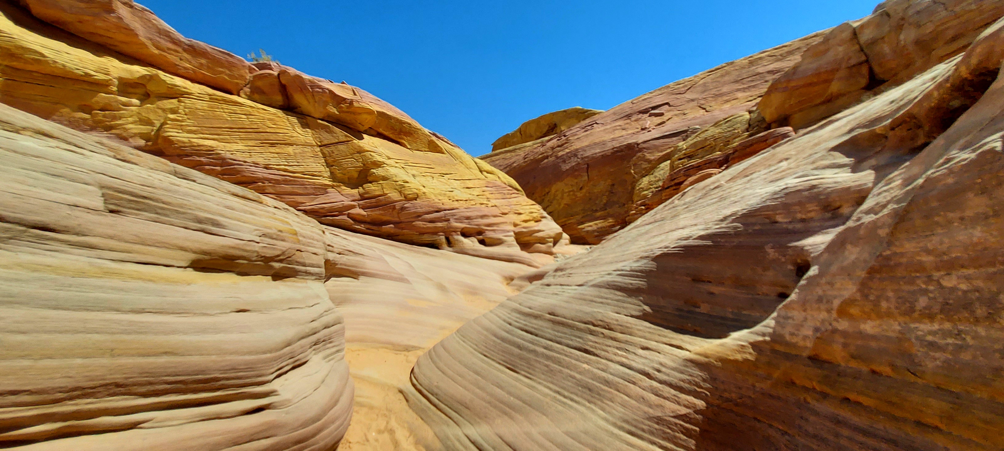
We continued on to the Upper Forks Trail, which leads to the various slot canyons. The first 1.25 miles was a series of switchbacks that were easy to traverse as we admired the unadulterated beauty along the Rim. Then it was time to connect with the Lower Forks Trail, which required hiking rock surfaces and sand on the downhill, which is more difficult for Mom's knees and her fear of falling from heights. So to combat her apprehension, she got quite chummy with the rock ledges, holding onto them tightly like a prom queen to her date. But Mom is a trooper and made it down to the trail for hiking the 3 slot canyons, Peek-a-boo, Spooky, and the Dry Fork Narrows. Peek-a-boo was way too challenging right from the start, having to scale a 12-foot vertical rock wall. Dad was able to hoist me up easily, but he had difficulty achieving the same results for himself. Mom refused to try at all. After we spoke to several folks who completed the Peek-a-boo Slot Canyon Hike and after watching others attempt the vertical wall, we voted unanimously to nix this “fun, challenging hike” described in the brochure. Spooky Slot Canyon was much easier to maneuver from the back end, though we only did a small portion since people were coming through the connection from Peek-a-boo and the Canyon is barely wide enough for 1 person. In fact, this is the first time we have visited a slot canyon that gives a “width test” back at the parking area before you start the trek. If you cannot pass through the gap between 2 poles they have planted in the ground, you aren’t going to make it through Spooky Slot Canyon. Though all three of us passed the girth test, we still had to suck it in several times during our short trek.
 |


I am happy to report that we did complete the entire hike through the final slot canyon, Dry Fork Narrows. We were thrilled that it was so much easier and wider than the other two slot canyons.


The next day we jumped on Maximus and headed down Scenic Byway 12. This is some terrific motorcycle riding, with plenty of twists, turns, and zigzags. We stopped at each viewpoint to enjoy the gorgeous vistas. As we climbed each summit, I thought for sure I was beyond the clouds and entering heaven. Yet, no matter how high our elevation, there was still mountain peaks towering above us.


 |
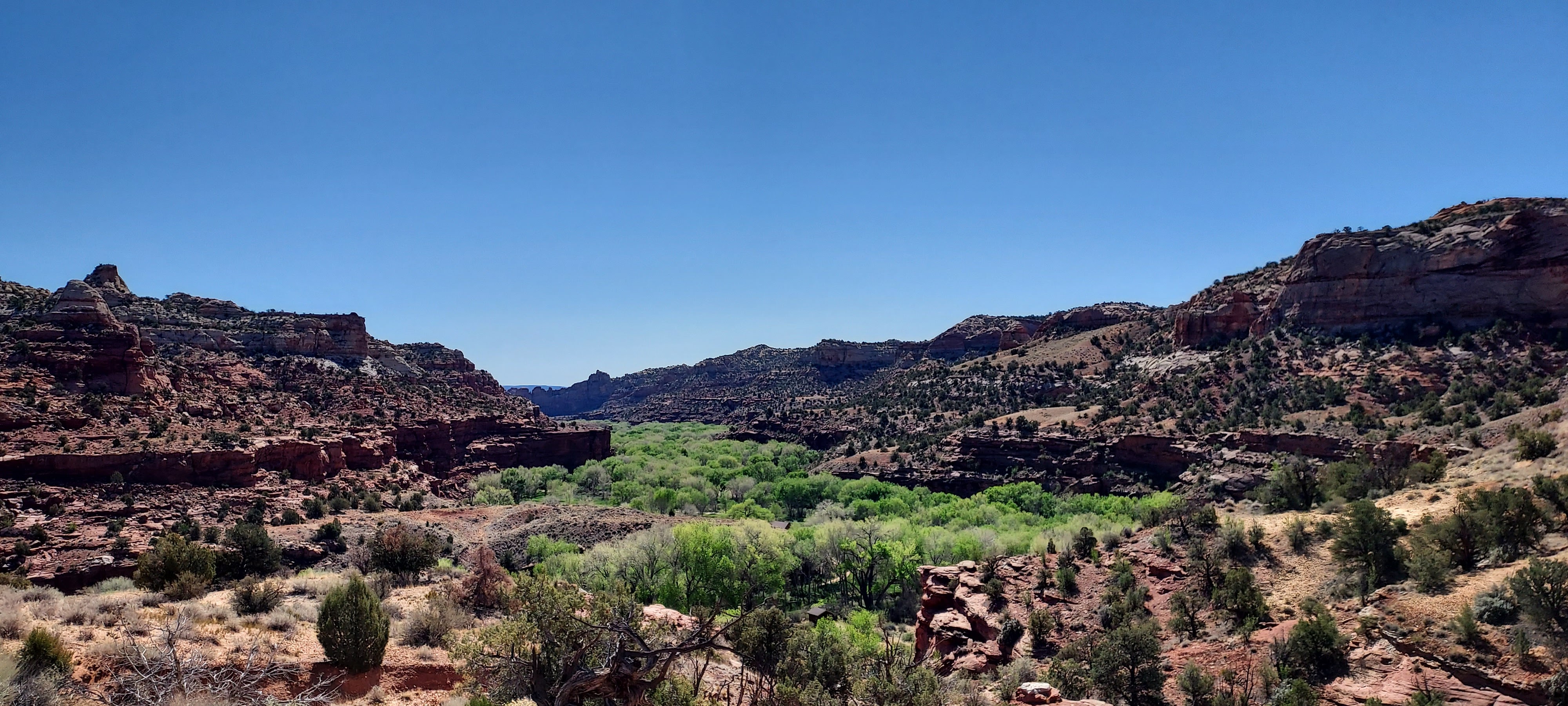
| The plush tree grove is down by the Escalante River, where we hiked later in the day. |

We drove through the outpost of Boulder, nearly as isolated and unpopulated now as it was when settled in 1890. They did not get electricity until 1947. Boulder holds the distinction of being the last Continental US mail route to use a mule train. Until the Civilian Conservation Corps built a road between Boulder and Escalante in 1940, it would take 3 days to get to Escalante via wagon along the old mail route. Today, you can hike this 15-mile route if you are so inclined.


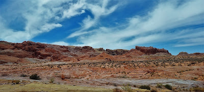
As we traveled along scenic Burr Trail Road, we were surrounded by the breathtaking red rocks of the Circle Cliffs. We stopped at Long Canyon. At only 75-feet in length, this slot canyon was a bit anticlimactic for me after yesterday’s endeavors, but beautiful just the same.
 |
| View of the Circle Cliffs |
 |
| View of the Circle Cliffs |
 |
| Long Canyon |
 |
| The road between the walls of the Circle Cliffs |
We enjoyed a picnic lunch along the trail at Deer Creek. As I sat on a log under one of the Cottonwoods that thrive there, I realized the spot must be a favorite hangout for grazing cows based on the amount of dung in the area. Scientists say the wonderful rock formations of Escalante National Monument developed over millions of years through the forces of nature. But I know the heavenly Father rightfully claims responsibility, for who created the wind, the rain, the soils of the Earth as tools for Mother Nature to design this unique canvas.
Next up was the Escalante River Natural
Bridge hike, which was an easy 4 miles round trip. Unbeknownst to us, we had to cross the river
8 times during the short trek. Mom diligently
took her boots and socks off for the first 3 crossings, then said
4gettaboutit. Dad left his on the entire
time and had to empty out puddles regularly because the water level was higher
than anticipated. (As a stuffed rat, I
am not burdened with wearing footgear--how great is that!) The riverfront trail was covered with
hundreds of caterpillars who hatched recently.
Some were eating, some were clinging to rocks and twigs for survival,
some had already passed to the great cocoon in the sky. The caterpillars weren’t the only creatures we
met along the trail—we were greeted by a bull snake, too.


 |
The next morning we tackled the 6-mile round trip Lower Calf Creek Falls Trail. We started at 9:45, so we enjoyed cooler temps and fewer folks on the trail. We arrived at the falls to find only about a dozen adults, 2 dogs, and no kiddos, so we got some great photos. I just loved watching the pooches romp in the water. We stayed about 30 minutes, enjoying the crisp air and cooling waters. On our return trip, the trail got super busy with adults, children, and canines starting their treks as the temps were reaching 85F degree. I bet there were some interesting interactions when they all arrived at the refreshing falls at the same time. Our brochure pointed out the locations along the trail of ancient granaries and pictographs (which I learned are images painted on the rocks versus petroglyphs that are carved/engraved on the rocks). However, they were too far in the distance to get decent photos. Though I did get a good pic of another bull snake we encountered.


 |
| Bull Snake |
It was time to take in some additional sights on Hole in the Rock Road, so we set out early the next day for Dance Hall Rock. This is where the Mormons shared fun and fellowship before undertaking the treacherous passing through the Hole in the Rock. I can see why they enjoyed music and dance here at Dance Hall Rock--the acoustics are phenomenal! They are so good that Dad heard what Mom said from 100 feet away when normally nothing registers from 1 foot away. Someone needs to put the acoustics of this Rock into a hearing aid for Dad! The views from Dance Hall Rock are spectacular—abundant beauty in every direction. Easy for me to say, but I suspect the Mormons on this journey would look out to the horizon apprehensively, not knowing what stood in front of them on their trek. The Hole in the Rock through which the Mormons passed through to cross the Colorado River is only 19 miles from Dance Hall Rock. So, onward we drove. Hole in the Rock Road was in decent shape—until the last 10 miles. Once we entered Glen Canyon National Recreation Area, the road conditions were abominable. And the winds had picked up dramatically. Several times I thought we would just throw in the towel. But, like the Mormons, we persevered. Mom was particularly psyched to get to Hole in the Rock. It has been on her bucket list for several years, especially after we visited Bluff, UT, where the Mormons established a settlement along the San Juan River, reaching their destination and completion of this mission. Until we arrived at the Hole and visualized the treacherous conditions, we did not truly understand the magnitude of the Mormons’ amazing feat: getting 83 wagons, 250 people including young children, and 1,000 head of livestock safely through the gap in the canyon’s sheer cliffs during January’s cold weather. We should all exhibit the tenacity, perseverance, and faith of these Mormon pioneers.


 |
| Dance Hall Rock |
 |
| Dance Hall Rock |


 |
| We encountered few humans, but many cows/cattle along our route. |
We attended a heartwarming Mother’s Day Church Service with
the Mormons on Sunday. Afterwards, we
completed a walking tour of the town of Escalante to see some of the many 100+
year old structures. We returned home as
the winds became ferocious (60 mph) throughout the next 36 hours. Sure glad the winds didn’t start until the
end of our visit or hinder our ability to tour Grand Staircase-Escalante
National Monument.

 |


I’ll talk to you again soon!


.jpg)


