We said our farewells to the wonderful folks we met and
worked with in Marcell, MN, hitched up, and traveled along MN-6. We were heading to Great Sand Dunes National Park and Preserve, utilizing our Harvest Hosts (HH) membership for a series of overnight stays. We stayed our first evening at The Farm of MN in Hutchinson, MN.
We were given a tour of this third-generation family farm operation whose produce (from shitake mushrooms to tomatoes, from squash to beans, and a
multitude of other veggies and fruits) is all certified organic. Dad was so excited, you’d think he won the
lottery! We spent $75 easily, packing
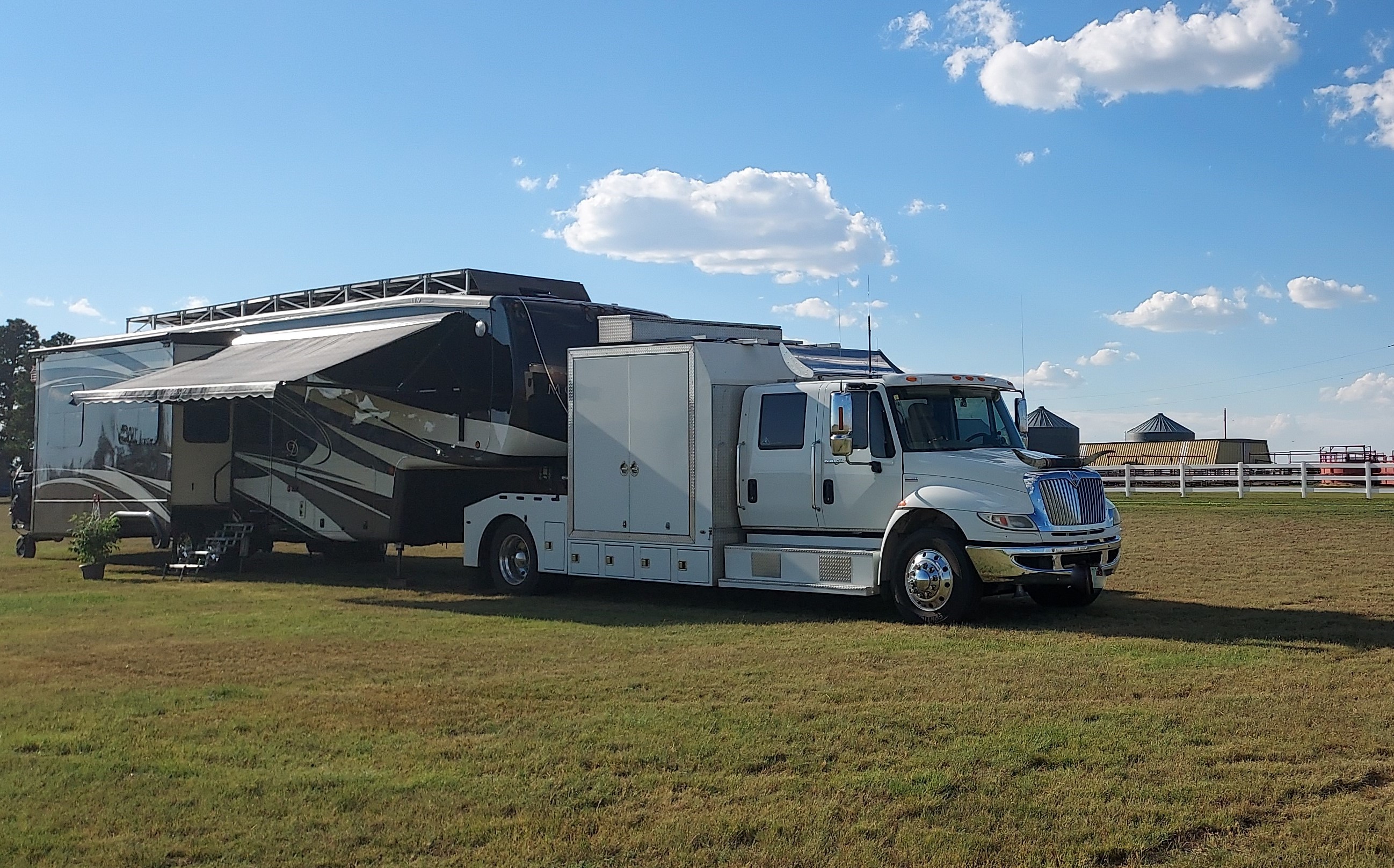
Suite Retreat, our 5th wheel, with lots of nature’s bounty. We enjoyed chatting with our hosts and
discussing a variety of topics including work-campers, which they may consider
recruiting in the future as the farm expands.
We accepted their offer to walk along the rest of their gorgeous 160-acre property, where we made the acquaintance of a deer, a hawk, a wild turkey, and
the resident alpine goat, Jack.


 |
| I spied a hawk on lookout for his next meal. |
 |
| Bambi was deciding whether I was friend or foe. |
 |
| Jack the Alpine Goat. |
We departed the next morning, traversing along US-71 and the
MN River Valley Scenic Byway. We reached Wolf Creek Trail Ranch, in
Anthon, IA, where the neighbor’s border collie had taken on the role of welcoming
committee. This HH site has 3-4 nicely-sized RV spaces and offers electric,
which we didn’t need. They sell lots of
local products: jams, wines, meats, and
poultry. Mom replenished her stock of
farm-fresh eggs and purchased some long-horn beef (Dad, being a University of Texas and Bevo
fan, was mortified by the latter). We
watched the resident horses get re-shoed and played with some of the dogs who
actually are owned by the Hosts.
 |
| The neighbor's dog is keeping a watchful eye on the equines as they wait to get some new shoes (though they won't be Jimmy Choo stilettos). |
 |
| Me and Dad in the Long-horn Garden. |
We were back on the
road the next morning. IA-31 South
beyond Oto is a terrible stretch of roadway in desperate need of repair with views of corn and soybean fields as far as the eye could see. As we crossed the Missouri River, we were in
NE. Our overnight accommodations were
provided by Diamond B Ranch, a HH horse motel. Though no horses were checked in for the
night, I visited with several barn cats who made the Ranch their personal bed
and breakfast. This Host provides water
AND electric at its site, so we topped off our freshwater tank with 25
gals. The Host also invited us to take
some peaches from her small grove. As
we picked about ½ dozen tasty peaches, I noticed we were not the only ones
looking for a delicious treat: a bull
snake was eating one of my brethren for lunch!
We presented our Host with a
monetary donation for the hospitality, then caught a lovely sunset as we walked
along the nearby rural roads.
 |
| One of the many resident cats. |
It was a glorious, sunny day as we traveled along I-80 and
US-34. We pulled over briefly at the
Massacre Canyon Historical Monument in Trenton, NE. This is where the last major battle between
Sioux and Pawnee tribes occurred. About
1,500 Sioux warriors attacked a group of Pawnees out hunting for buffalo. The result was 150 Pawnees dead, mostly women and children. History shows that the White Man was not the
only one to commit atrocities against Indians.
In fact, the conflicts between tribes occurred for centuries. After all, every person is a part of humankind and
shares the same character traits: the good ones, the bad ones, and even the ugly ones.
We arrived at Nel’s Cabins and RV Park, and we were greeted by Nel herself with warm hugs and fresh home-baked
cookies. MMM, soooo good! Though we stayed as members of Harvest Hosts, anyone can stay at Nel's RV Park. Nel and her hubby Johnny have several horses on the property with which we visited, including Mamma and
her new colt. Though they proceeded
cautiously to the fence, they became my bosom buddies when they saw I had treats
for them. We
shared interesting conversation and fellowship with Nel and Johnny along
with another guest Diane.
 |
| Mamma and her colt. |
 |
Diane's doggie, Hooch.
|
The next morning we returned to the Ancient Indian Traders
Trail, US-34/KS-161. These parts of KS
start out as rolling hills, but quickly transition to flat, fertile farmlands
filled with fields of sorghum (say that 3 times fast!). We
connected to the Land and Sky Scenic Byway, where the tallest buildings found
are grain silos. Welcome to Colorado,
where we did a dump/pump at the Visitor Center.
Then we arrived at Buffalo Ridge, our final HH overnighter in Lymon,
CO. We were invited to participate at 6
p.m. in a 25-person tour followed by a cookout consisting of bison burgers,
beans, chips, and cookie for $35/person.
I sure am glad that Mom is antisocial and nixed this option, ‘cause I
would have been famished waiting for the 1.25 hour tour to conclude and the
cookout to commence at 7:30 p.m. Not to
mention, Dad couldn’t eat a blessed thing on the menu.
So, we opted instead to purchase several mouth-watering bison steaks and
farm-fresh eggs for Mom and me to enjoy.
Then we checked out the property.
We kept getting the stink-eye from the bison who reside at the ranch--I
am certain they knew we just stuck their friends in our freezer. Lots of annoying flies and mosquitoes feasted
on us as we walked, but witnessing the magnificent sunset and meeting a rogue llama
made up for the annoyance.

 |
| I really didn't appreciate the way these bison glared at me. |
 |
| Larry the Llama out on the lam. |
 |
| Such an idyllic place. We are so blessed to witness God's Country. |
We arose the next morning to sunshine and comfortable temps
of the high 60sF. We took US-71 through
miles and miles of pasturelands, and I found it necessary to moo at the inhabitants as we passed. The Spanish Peaks, which once were in our
distant view were now front and center as we traveled along US-160.

We entered the San Luis Valley of Colorado. It was settled by Mexicans who received land
grants by their government to create homesteads in unchartered
territories. It is a very pretty area,
though you wouldn’t know it from the photos I took because the windshield was splattered with dead bugs. And the
roads were so rough, I thought those eggs Mom purchased would surely be
scrambled. We were trying to reach our
boondocking site, Mosca Campground in the San Luis Lake Wildlife Area along
CO-6N. We specifically tried to access
CO-6N from US-160 because we knew from our research (websites, Facebook pages,
phone calls) that 6N was closed for construction off US-150. Well, apparently the powers-that-be never
bothered to post updates anywhere and the construction from the
US-150 entrance finished recently. But now construction had commenced along the US-160 entrance. Then Gretchen, our GPS, provided an "alternate route" which took us on
a wild goose chase down dirt roads that led to nowhere. So, we decided to forego
our boondocking plans and checked in at the Alamosa Great Sand Dunes KOA. At $69/night, it is a bit pricey compared to
boondocking, but we were given a spacious, easy-access pull-through site. And when we investigated the Mosca Campground
the next day enroute to Great Sand Dunes National Park, we realized we dodged a
bullet. Though the views are phenomenal, the turns within the campground are way too tight. There is no way a set-up of our size could ever maneuver.
 |
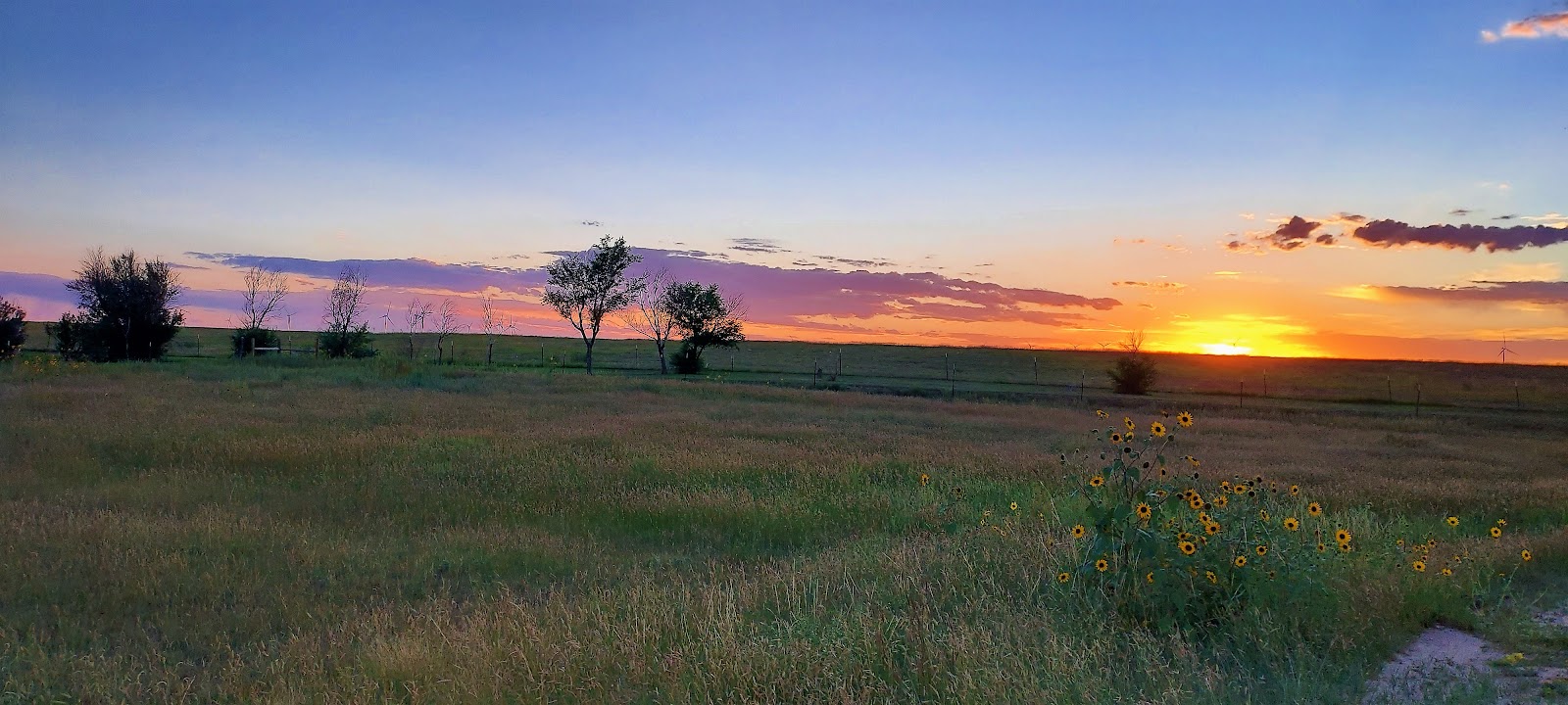
| Driving to Mosca Campground, the roadway was bordered by beautiful sunflowers. |
 |
Spectacular views from the Mosca Campground in the San Luis Wildlife Area...
|
 |
| ...But the Alamosa Great Sand Dunes KOA offered some nice scenes, too. |
Great Sand Dunes National Park contains the tallest dunes in
North America. We stopped at the Visitor
Center, which seemed to be still in 2020 COVID-mode. Rangers continued to hide behind plexiglass while wearing masks, and the Park still prohibited anyone into the
auditorium to view the film. Though I
would have loved to scale Star Dune, we all agreed that it just wasn’t happening at a 7-mile round trip hike in the heat of the day. Instead, we climbed several smaller dunes. The sand here is quite different than what we have experienced at ocean beaches or even at White Sands National Park. Here the sand is very course and multi-colored. That is because it represents sediment carried via water and wind from the San Juan and Sangre de Cristo Mountains. I couldn’t resist leaving my mark in the sand. Don't worry, I didn't deface anything. In fact, Mother Nature's wisps of wind swept my artwork away quickly. We walked across Medano Creek. Yesterday’s monsoon shower left water flowing through the sand base. I watched a pinecone as it traveled down the faux river. We then hiked the Montville Nature Trail along Mosca Creek. It is a short ½ mile loop that gives a glimpse of the area’s past. There is evidence that humans lived here more than 11,000 years ago. We checked out Pinon Flats Campground—not an option for large set-ups. Then we strolled along the Sand Sheet Loop Interpretive Trail, viewing the plants and grasslands that thrive along the dunes. We returned to the Visitor Center for me to be sworn in as Junior Ranger.

 |
| Medano Creek |
 |
The Rambling RV Rat sand art, a self-portrait.
|
 |
| Montville Nature Trail... |
 |
| The plateau fence lizard, one rather large reptile. |
 |
Flora along the Interpretative Trail.
|
 |
| My latest Junior Ranger achievement. |
We spent our final day at Zapata Falls
Recreation Area. The sign that warns the
“2.8-mile road ahead is rough and rocky” must be outdated because Big Boomer
was greeted by newer chip seal and wide roads.
This roadway to the Falls parking area offers spectacular vistas and is
well worth the ride up even if you don’t plan to hike to the falls. There is a lovely picnic area, where we
enjoyed lunch before heading to the falls.
It is a short ½ mile trek to the falls, but it comes with a 400-foot
elevation gain on a rough, rocky trail.
Then you must maneuver across the running waters of Zapata Creek
several times, with water levels reaching calf-height (knee-height for
vertically-challenged folks like me and Mom.)
Fortunately, the rocks beneath our feet were not slick. But even on an 80F degree day, the water was
chilly. Surprisingly, Mom participated
until the final Creek crossing, when she called it quits and just filmed Dad as
he reached the finish line. Then we all
had to backtrack, crossing the Creek several more times.
 |
| Looking downhill along the road to the Falls Parking Area. |
 |
| Views from the Zapata Falls Parking Area. |
 |
| A butterfly went airborne in the middle of my photo from the parking area for Zapata Falls. |
 |
| Our secluded picnic spot before our hike. |
 |
| Views from the Picnic area. |
 |
| Look at the size of the burl! |
We returned to the parking area and decided
to check out Zapata Campground, which is run by Bureau of Land Management (BLM). What a
boondocking gem! We found at least 3 huge level sites that
could accommodate our set-up easily. Oh
well, live and learn.
Before going back to the KOA, we stopped at Alamosa National
Wildlife Refuge to see if any migrating birds were on premises. Other than a duck or two, there wasn't much going on bird-wise nor human-wise for that matter. It was 2:25 p.m., well beyond lunch time and too early for quitting time. And yet, the Visitor Center was closed. The sign says it is only “open when adequate
staffing is met.” (Can you imagine if
a real business operated like this?) All right, we will stroll along the
Rio Grande Nature Trail instead. Alas,
this too is closed for the season “for protection of the endangered Southwest Willow Flycatcher”. We decided to take the Auto Tour, but we soon
determined that most of the signs and numbers were missing, though we did enjoy breathtaking views of the Sangre de Cristo Mountains. We intersected with another
road and wondered, “what’s down there?”
But the common theme of “closed” prevailed for this road as well. It really gets my tail in a tangle to see all
the land the government controls that we can never use or access.
 |
| Not even the swallows were around. |
 |
| We went to hike the Rio Grande Nature Trail, but found it closed. |
 |
| The Refuge did provide a nice photo op of the Sangre de Cristo Mountains. |
Well, we are on our way to Santa Fe tomorrow, so I'll sign off now. I’ll talk to you again soon!


No comments:
Post a Comment